The South Carolina section of the Southeast Coast Saltwater Paddling Trail extends 295 miles from the Savannah River at the Georgia border through the Carolina Sea Islands, past the port of Charleston, along the Grand Strand, and ends at Little River on the North Carolina border. This section offers a paddling trail with a diversity of natural and cultural features, and includes every South Carolina coastal habitat type, from tidal waters, marshlands, and swamps to barrier islands, dunes, and beaches. Many cultural sites and places of interest are accessible by kayak including old forts, plantations, fishing villages, port cities, resorts, and many protected wildlife areas.

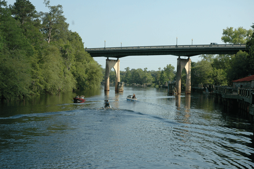
Waccamaw River, SC. Photo Credit: Michael Foster/SC DNR
Savannah River to Beaufort – Enter the south end of the trail from access points in Georgia or from South Carolina landing sites that access the Wright River or New River. Important wildlife areas on the paddling trail include Turtle Island Wildlife Management Area, Daws Island Heritage Preserve, Joiner Bank Seabird Sanctuary, Old Island Heritage Preserve, and Hunting Island State Park. Important cultural areas include the Charlesfort-Santa Elana site of 16th century French and Spanish settlements at Parris Island Marine Corps Depot. Haig Point on Daufuskie Island features a historic lighthouse and a modern lighthouse is at Harbor Town, Hilton Head. The City of Beaufort offers cultural charm and a significant historic district. Nearby vacation and beach destinations are at Hilton Head Island, Fripp Island, and Hunting Island State Park.
Beaufort to Edisto Island, the ACE Basin – The paddling trail enters the ACE Basin National Estuarine Research Reserve (NERR) as it passes through waters of St. Helena Sound and the Ashepoo, Edisto, and Combahee (ACE) Rivers. The ACE Basin NERR is one of 27 national reserves located along the US coastline. This NERR is a significant portion of the greater ACE Basin Project focus area, which has been the target of significant public and private land conservation. Related areas near to the paddling trail include the ACE Basin National Wildlife Refuge and Bear Island Wildlife Management Area. Nearby vacation and beach destinations include Edisto Island, Edisto Beach, and Edisto Beach State Park.

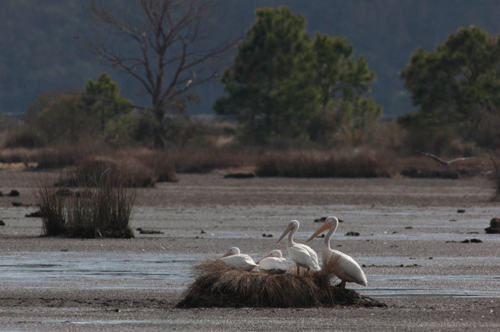
Bear Island, SC. Photo credit: Michael Foster/SC DNR
Edisto Island to Charleston – Important natural areas on the paddling trail include Botany Bay Plantation Wildlife Management Area, Deveaux Bank Heritage Preserve, Bird Key Stone Heritage Preserve, Lighthouse Inlet Heritage Preserve, and Crab Bank Heritage Preserve. Important cultural areas on or near the paddling trail include the Charleston Battery, Castle Pinckney historic site, Patriots Point Museum with the USS Yorktown, and Fort Sumter National Monument which includes Fort Moultrie and Sullivan’s Island Lighthouse. The port city of Charleston, founded in 1670, is considered a “must see” Old South city widely acclaimed for its charm and beauty and significant historic district. Nearby vacation and beach destinations include Edisto Island, Seabrook Island, Kiawah Island, and Folly Beach.

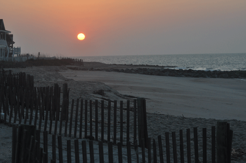
Edisto Beach, SC. Photo credit: Phillip Jones/SC DNR
Charleston to McClellanville – Important wildlife areas on the paddling trail include Capers Island Heritage Preserve, Francis Marion National Forest,and Cape Romain National Wildlife Refuge. Historic Cape Romain lighthouses are on Lighthouse Island. The Town of McClellanville features a historic district. Buck Hall Recreation Area is adjacent to the trail. Nearby vacation and beach destinations include the Isle of Palms.
McClellanville to Winyah Bay at Georgetown – Important wildlife areas on the paddling trail include the Santee Coastal Reserve, Tom Yawkey Wildlife Center Heritage Preserve, and the North Inlet-Winyah Bay National Estuarine Research Reserve (NERR). This NERR is part of the adjacent research reserve of Hobcaw Barony, which includes the Belle W. Baruch Institute for ecological research. The historic Georgetown Lighthouse is at North Island. Georgetown was once an important international port that served the area’s once-thriving rice plantations and now features a significant historic district and Rice Museum. Georgetown’s Morgan Park and East Bay Park are adjacent to the trail.
Georgetown to Socastee, the Lower Pee Dee & Waccamaw – This section travels along the lower reaches of the Great Pee Dee and Waccamaw Rivers, includes a portion of the Waccamaw River Blue Trail, and enters the Atlantic Intracoastal Waterway canal at Socastee. Important wildlife areas on the paddling trail include Samworth Wildlife Management Area, Sandy Island Preserve, and the expansive Waccamaw National Wildlife Refuge. Brookgreen Gardens is adjacent to the trail and features the world’s largest sculpture garden. Nearby vacation and beach destinations include Pawleys Island, Litchfield Beach, Huntington Beach State Park, Murrells Inlet, and Garden City. Historic districts are found in Georgetown and Socastee.
Socastee to Little River, the Intracoastal Waterway – This portion of the trail follows a 30-mile canal created in 1936 by the US Army Corps of Engineers for the Atlantic Intracoastal Waterway. Here the paddling trail generally parallels the popular tourist area of the Grand Strand, which encompasses Myrtle Beach, a dozen other beach communities, plus Myrtle Beach State Park. Vereen Memorial Gardens Park is adjacent to the trail at the town of Little River.

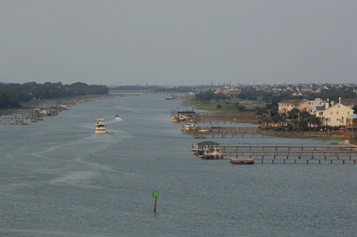
Intracoastal Waterway. Photo credit: Michael Foster/SC DNR
Related Resources
- South Carolina Department of Natural Resources
- South Carolina managed lands
- Scenic Rivers and Water Trail Guides
- South Carolina State Parks
- South Carolina State Trails Program
- SC Water Trails
- South Carolina Official Tourism Site
- SC Islands and Coast
- SCIWAY – South Carolina’s Information Highway
- SC Outdoor Recreation Guide
- Charleston County Park and Recreation Commission
- Waccamaw River Blue Trail
- Berkeley County Blueways
- ACE Basin (visitors guide)
- Paddling the ACE
- South Carolina Nature-Based Tourism Association
- South Carolina Paddlesports Industry Association (includes directory of retailers, tours, and rentals)

